|
|
|
| Product Advantages: |
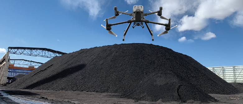
1) automatic obstacle avoidance, autonomous flight, and aerial inventory of coal piles in arched sheds.
2) automatic route planning, automatic aerial photography and return.
3) one-key take-off and landing function.
4) Real-time adjustment of heading is possible.
5) system configuration and data saving, the same site can be set once.
6) fully automated high-precision three-dimensional modeling, with coal pan accuracy of 99.5% or more.
7) Ability to subtract invalid data outside the coal field area.
8) the function of unified inventory and partitioned volume calculation can be realized
9) automatic generation of standard format report.
10)Different coal fields can be displayed in different colors for easy differentiation.
|
| UAV coal pan effect: |
| |
| |
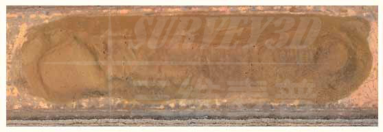
Live shooting
|
| |
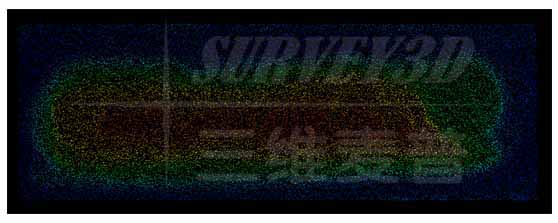
Dense point cloud
|
| |
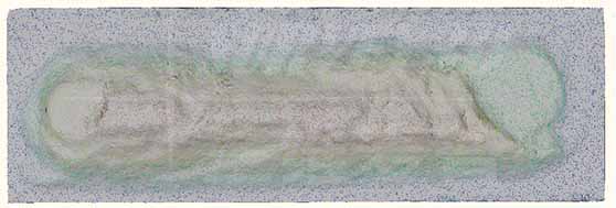
Rendering of coal yard
|
| |
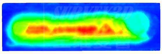
Elevation rendering effect
|
| |
| |
| Technical parameters: |
| |
|
| Product Type |
Professional-grade quadcopter |
| |
|
| Product weight (without battery) |
3.7kg |
| |
|
| Flight radius |
0-8200m |
| |
|
| Hovering accuracy (no wind environment) |
Vertical: ±0.1 m Horizontal: ±0.2 m |
| |
|
| Upward speed |
7m/s |
| |
|
| Descent speed (vertical) |
5m/s |
| |
|
| Flight Speed |
17 km/h |
| |
|
| Symmetrical motor axis distance |
900mm |
| |
|
| Adaptation to working environment temperature |
-20°C to 60°C |
| |
|
| Wind resistance class |
Less than 7 levels |
| |
|
| Flight time |
58 minutes |
| |
|
| Protection level |
Rainproof and dustproof |
| |
|
| Vision sensing navigation system |
With visual collision avoidance system, southeast, northwest and up and down six directions to avoid obstacles |
| |
|
| Infrared sensing system |
Six-way infrared sensing system |
| |
|
| Battery Capacity |
About 6000mAh |
| |
|
| Battery Type |
Lithium Battery |
| |
|
| Battery weight |
Approx. 1.3kg |
| |
|
| Camera weight |
683g |
| |
|
| Camera size |
155×120×160mm |
| |
|
| Camera Waterproof Rating |
Waterproof and dustproof |
| |
|
| Camera operating temperature |
-20°C to 50°C |
| |
|
| Camera Pixels |
20 million |
| |
|
| Data processing computers |
| |
|
| Screen size |
14inch |
| |
|
| Processor |
Intel Core i5 |
| |
|
| Memory |
8G |
| |
|
| Hard Disk |
500G and above |
| |
|
| Flight Control Software |
| |
|
| Smart Navigation |
The software is easy to operate, with intelligent navigation functions, the user can follow the prompts to operate the steps |
| |
|
| Route Planning |
Automatic route planning, automatic aerial photography and return |
| |
|
| Background Map |
With national background map |
| |
|
| One-touch take-off and landing |
One-touch take-off and landing function |
| |
|
| Software Features |
|
| |
|
| Real-time monitoring |
Real-time adjustment of heading |
| |
|
| Memory Storage |
System configuration and data saving, set up once for the same site |
| |
| Automatic calculation |
Automatically generates pile volumes on flat surfaces or slopes without the need for manual pointing to determine the reference ground |
| |
|
| Automatic leveling |
With automatic leveling function of coal yard ground |
| |
|
| File Import |
Can import ply 3D model files |
| |
|
| Volume correction |
Automatic deduction of the volume of the concrete building buried at the bottom of the pile |
| |
|
| Calculation accuracy |
Fully automated high-precision 3D modeling, over 99.5% accuracy of disc material |
| |
|
| Intelligent noise reduction |
Ability to remove invalid data from outside the yard area, ability to calculate volume and weight |
| |
|
| Partition Calculation |
Can realize the function of unified inventory, partition calculation volume, data editing function |
| |
|
| Three-dimensional view |
Display all yard models in one interface, and support 3D dynamic view |
| |
|
| Color rendering |
Invisible foundation surface processing function: for the foundation surface is deeply buried under the material pile, this function can be used to automatically deal with the situation to eliminate the error |
| |
|
| Upgrade Extensions |
Software can be integrated with other laser counting devices for future upgrades and expansion to automatically generate standard format reports |
| |
|
| |
| |
| |
| |