|
|
 |
|
|
%20-%20Leica%20Geosystems%20-%20Leica%20Geosystems.files/pix.gif) |
| |
|
|
|
| Product name: |
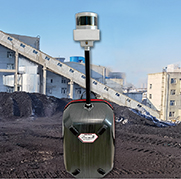
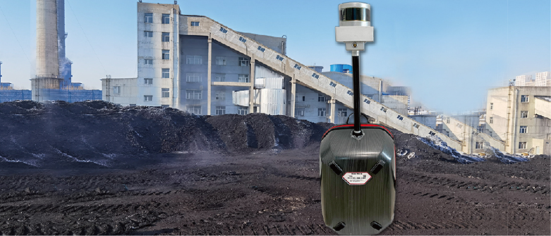
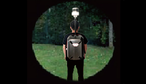
M30 Handheld backpack laser scanner |
| model: |
M30 |
| Brand: |
|
| Quotation: |
|
|
|
|
| |
| Product introduction |
1) The method of synchronous positioning and composition is adopted for measurement, which is easy to use. It takes 10 minutes to get started and walk around the coal pile for a few minutes to form a map;
2) The main body of the equipment weighs less than 1.6kg, can scan 300000 points per second, the scanning radius of highly reflective objects is more than 100m, the measurement accuracy is higher than 3cm, and the volume error is better than 0.5%;
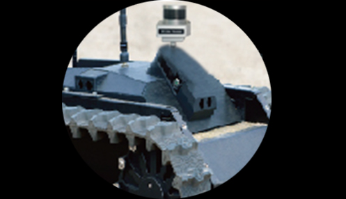
3) It can be refitted into hand-held, vehicle mounted, shipborne or unmanned aerial vehicles. If it is suspended on the rail car, the 200m long stockpile can be swept in 5 minutes, and it can be used before, during and after the construction of the coal shed;
4) The measurement data graph can be viewed on the tablet computer, and automatic noise reduction processing can be carried out on the computer end, and the report can be displayed with one key;
5) No GPS signal is required, no control points need to be arranged in advance, and the measurement can be completed by walking a circle back to the starting point;
6) It can be upgraded to precision scanning mode and fixed on the roof of the shed to achieve 2-second high-precision scanning. It can scan silos, oil tanks, cabins, coal sheds and other enclosed spaces;
7) The target ball can be selected to convert the coordinate system of the data, the backpack bracket can be selected to release your hands, so that you can walk more safely, and the image stabilization platform can be selected to reduce the impact of vibration on the scanner;
|
| Technical parameter |
Product parameters |
Range |
>100m |
Sampling rate |
300000 points/second |
Travel speed |
Less than 2 meters per second |
Vertical range |
> 30 degrees |
Horizontal range |
No blind area in 360 ° |
| Scanning accuracy |
Above 3cm |
| Working temperature |
-30 to+60 |
| Operating humidity |
95%, non condensing |
| Scanning frequency |
5-20Hz |
| IP rating |
IP67Waterproof and dustproof |
| Instrument weight |
1.6kg |
| Body size |
120×150×260mm |
| Laser class |
Class 1 Eye Safe Laser |
| Laser wavelength |
905 |
| Battery type |
12V, 6200mAh rechargeable lithium battery |
| communication interface |
LEMO plug |
working hours |
Can work continuously for 4 hours |
| Main control parameters |
Memory capacity |
8G+256G |
| Data interface |
USB+network port |
Screen size |
10 inches |
| Software function |
Data processing |
Real time data receiving |
Noise removal |
Automatic noise reduction |
| Report method |
Any heap terrain can be reported by one click |
| Coordinate transformation |
Coordinate conversion with 3 points |
| Data format |
Multiple common data formats such as ASC can be exported |
| Point Cloud Display |
2D and 3D color graphic display |
|
|
|
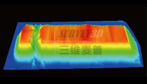
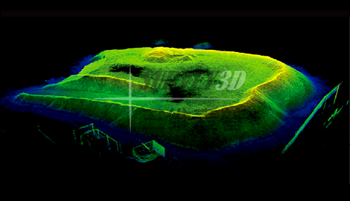
| Rendering display |
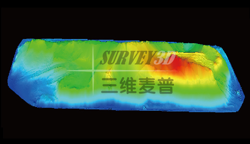
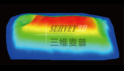
| The color rendering is as follows:
|
|
|
|
|
|
|
|
| |
|
| |
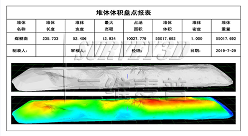
| One click report is as follows: |
|
| Application area |
It can work normally under various complex and harsh environments, such as coal mining, underground space, forestry industry, building survey, ancient building survey, etc., and can be scanned by hand and deployed quickly
It works in three complex environments, and has a 360 ° scanning field of view. The scanning is faster and more accurate, and the obtained point cloud data quality is higher.
|
|
| Mine explosion-proof intrinsically safe three-dimensional laser scanning |
|
| Calculation and change analysis of reactor volume in power plant |
|
| Building 3D scanning and earthwork survey |
|
| Digitization and 3D modeling of coal yard |
| |
| |
| |
|
|